
Dynamic Outlook has the ability to provide a well rounded and complete GIS service to a diverse set of clients. Listed below are some examples of the type of the projects Dynamic Outlook has completed:
- As-Build/Facility/Site Mapping
- Crop Damage and Compensation Mapping
- Environmental Assessment Mapping
- Race Mapping
- Restricted & Noxious Weed Mapping
- Trail Mapping
- Vegetation Community Mapping
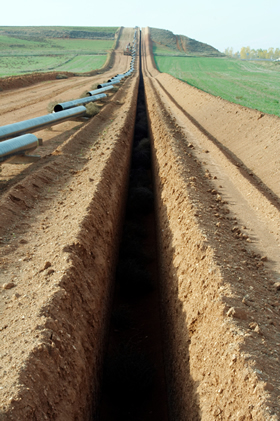
As-Build/Facility/Site Mapping
Due to their business objectives it is extremely important for some organizations to have access to accurate digital representations of the facilities they manage. The resulting digital map and associated attribute table will assist organizations with the ability to analyze and visualize spatial features and relationships for effective facility management and planning. Therefore, it has become imperative that a digital spatial library of facilities be constructed for future mapping needs.
Dynamic Outlook's experience with facility mapping, or 'as-build mapping', is a more cost effective alternative to a 'survey' done by an engineering firm or survey company. The primary focus is the collection of "above-ground" features via GPS and, if needed, the mapping of how the "below-ground" facilities tie in with those "above-ground" facilities. In this way, buried waterlines, valve nests, etc. can be easily located and managed via a GIS.
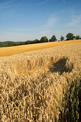
Crop Damage and Compensation Mapping
Crop damage due to wild ungulates is an economically and politically difficult problem. When faced with mapping and linking collected data for assessment, mitigation, and compensation for crop damage, program organizers require accurate mapping and database management for successful program implementation.
When livestock groups and cattlemen's associations within British Columbia needed GIS support for their crop damage, mitigation, and compensation programs they came to Dynamic Outlook for experienced help. Dynamic Outlook designed and implemented a GIS that increased the accuracy and effectiveness of the programs, resulting in major savings and increased professionalism.
Environmental Assessment Mapping
Environmental assessment work for oil and gas developments within the Foothills of southwestern Alberta requires extensive data collection, analysis and planning.
Dynamic Outlook is proud to have worked with the dedicated leaders and specialists who do this assessment work. We continue to work with the:
- Reclamation specialists of Gramineae Services,
- Vegetation experts of Alta-Rangeland services,
- Hydrology specialists of Matrix Solutions,
- Wildlife experts of Anatum Ecological Consulting and the
- Soil specialists of Landwise Inc.
By making sure all of their spatial data is accurately collected, managed, analyzed, and displayed, Dynamic Outlook provides a valuable GIS service for each oil and gas development environmental assessment - both well lease and pipeline construction.
Race Mapping
When faced with planning a racing event, organizers need to have accurate and effective mapping for race planning and event advertisement.
When Rocky Mountain Events needed mapping and analysis for a 100km Relay Race they enlisted the help of Dynamic Outlook. We were able to GPS prospective course routes for analysis and put together their final race mapping package.
Restricted and Noxious Weed Mapping
There are many alien plants in Canada. Within this group of alien plants there is a small collection has the ability not only to grow in natural areas but also to thrive in them. The result is that these alien species propagate at the expense of the original native flora. It is these species that are a cause for concern for many public and private organizations.
Dynamic Outlook has considerable experience in providing GIS/GPS support to weed management programs within the private and public sectors. We have served in multiple capacities; everything from organizing weed inspection and treatment contractors to actual GPS inventory and GIS analysis.
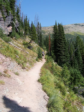
Trail Mapping
The use of All-Terrain-Vehicles (ATV's) is a very popular and enjoyable recreational activity for a growing number of North Americans. With the increases in technology and favourable economics, it is easy to see that the use of ATV's in North America is expanding at an incredible rate.
By working with our clients we have been able to effectively use GIS/GPS to answer all our clients' questions, and to meet their trail management and planning needs.
Vegetation Community Mapping
Accurately mapping vegetation communities for analysis is extremely important for the effective management of grazing within Alberta.
Dynamic Outlook has been successful procuring several contracts with the Alberta provincial government requiring the accurate capture and analysis of vegetation communities for grazing management on public and lease lands.